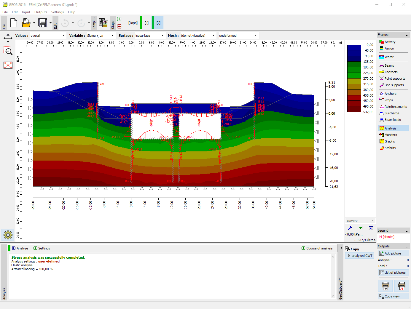
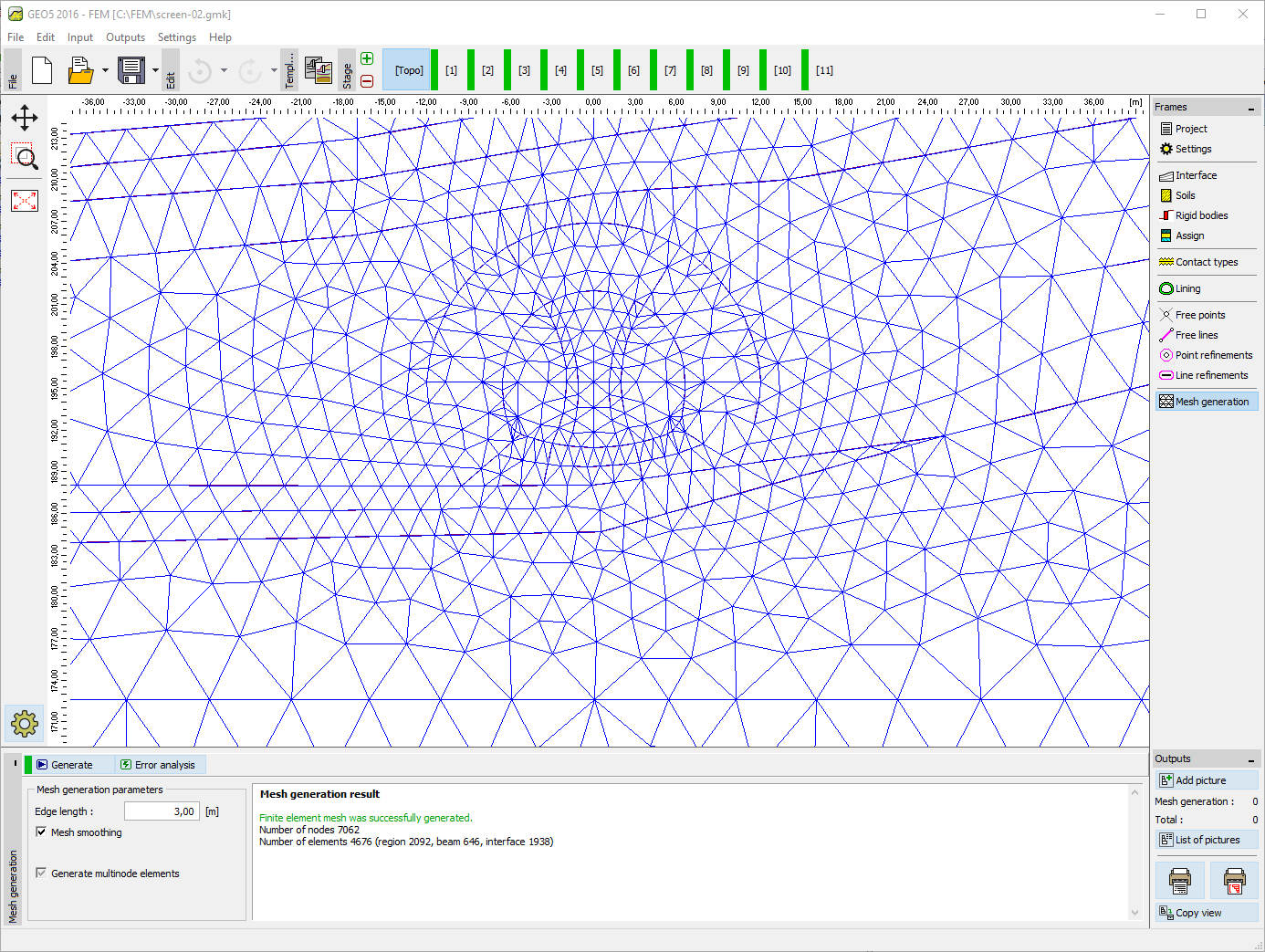
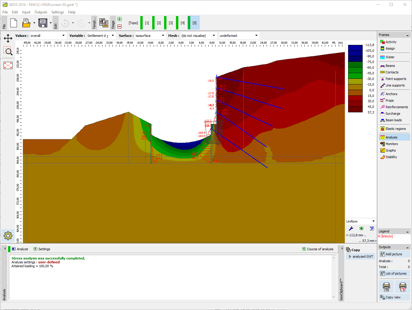
This program, based on the finite element method, can model
and analyze a wide range of geotechnical problems, including terrain settlement, sheet pile/diaphragm walls, slope stability, excavation analysis. It offers several material models for soils and a variety
of structural elements such as walls, anchors, geotextiles
or geogrids. The GEO5 FEM is used to compute displacements, internal forces in structural elements, stresses and strains
and plastic zones in the soil and other quantities in every construction stage.
With extension modules the program also performs the Tunnel excavation analysis, the steady sate or transient Water Flow analysis, the coupled Consolidation analysis, or the dynamic impact of an Earthquake.
More Features
GEO5 generates output reports in variety of languages - useful for foreign projects.
Our tutorials and manuals guide you quickly through the programs.
GEO5 contains catalogs of profiles, sheet piles, anchors, nails, geogrids and blocks.
GEO5 programs have unified environment and intuitive top-down workflow.
GEO5 integrates geological data modeling with advanced geotechnical tasks.
GEO5 enables comparison of two independent solutions.
Collect geological data in the field and send it to the Stratigraphy program.
GEO5 export data to common BIM formats and share them with third-party programs.
GEO5 is a universal tool for engineers all over the world.
GEO5 output reports can be easily edited or exported to PDF or MS Word formats.
GEO5 enables to transfer data between individual programs.
GEO5 generates output reports in variety of languages - useful for foreign projects.
Our tutorials and manuals guide you quickly through the programs.
GEO5 contains catalogs of profiles, sheet piles, anchors, nails, geogrids and blocks.
The software in general is very good and ties in well with the way we do things here. From our review, the calculation results compares very well with our methods for both slope stability and settlement. The graphics and the ‘point-and-click’ data input are also very good and makes the program very easy to use.
It’s really great how easy the software is. I’m now doing the calculations so much faster and easier than doing it manually and most importantly, the technical customer service team are great and they respond instantly and professionally to any question or clarification. Thank you guys for being so awesome. High fives!
Great software....highly recommend.....always updating/improving and implementing feedback from users.
Activate the 14-day Trial Version without analysis restrictions for free.